Cover Story: Before the Storm
By Adrian Gerold | September 1, 2007
Send Feedback
One expression we don’t see in newspapers these days, or hear on radio and TV, is "air pockets," those Bermuda Triangle-like potholes in the sky that airliners used to routinely fall into. What has changed is the almost universal adoption of weather radar in virtually all instrument-flight capable aircraft, from medium twins on up. Those airframe rattling potholes are still up, except that they are now more sensibly described as turbulence, which weather radar allows us to avoid, most of the time.
In its early days, radar simply brought a weather piercing eye to the flight deck, to show significant weather systems ahead. But the equipment was totally unlike any of the other onboard avionics systems, all of which gave positive indications of results when activated. Even when operating perfectly, radar required pilots to judge, largely based on their experience, exactly what the picture on the screen was telling them. Pilots primarily were aided by interpretative rules of thumb, such as "avoid flying between apparently separate weather cells" or "never fly near potential hail bearing ‘hook’ shapes on the radar screen." But interpretation of the radar’s presentation was then — and with many current systems still is — a challenge for new pilots.
The main problem has always been that of discriminating between weather and ground returns. While weather radar depends on its signals being reflected back from rain and, occasionally, wet hail, its signals also reflect back equally well from the surface, particularly from undulating terrain, large built-up areas and mountains. In these situations, a severe thunderstorm dead ahead could be indistinguishable from a large city with a high rise downtown area, while a mountain range could hide a solid line of thunderstorms along its face. But even in moderate weather and ground clutter situations, the mixed returns hamper accurate detection of unique hazards, such as windshear and localized areas of strong turbulence.
Until recently, separation of true weather returns and ground clutter has been accomplished by the pilot’s use of the radar tilt control to gradually raise the radar beam so that it no longer scans the ground. Sometimes, pilots will also reduce the system gain, although that often risks lessening both weather and surface returns.
Raising the beam works reasonably well, although raising it too high in an attempt to eliminate all ground returns risks losing lower-altitude weather. On the other hand, the much wider beam width of smaller radar antennas simply cannot avoid the terrain at longer ranges. With radar antennas, beam widths increase as their diameters reduce, causing a smaller aircraft’s 10-inch antenna to have a 9 degree beam, while an airliner’s 30-inch unit produces a much narrower 3-degree beam, sometimes called a pencil beam. Overall, therefore, manual tilt adjustments help reduce the effects of ground clutter, but they can limit a system’s full weather alerting potential.
Consequently, a good deal of effort has gone into developing ways to optimize radar in order to clearly distinguish weather returns and associated phenomena from ground returns. One result has been the introduction of fully digital systems, exemplified by Honeywell’s RDR-4000 Weather Radar and Rockwell Collins’ WXR-2100 MultiScan Hazard Detection System, which introduced a high level of automation, and which subject the returning data to intensive computer processing before displaying it to the pilots.
With both systems, tilt, gain and pulse lengths are automatically and continuously adjusted, ground returns are removed entirely from the weather presentation, windshear and high turbulence areas are clearly identified and alerted, and the radar display is automatically optimized around the planned climb, level or descent flight path.
The only crew input required is the selection of the presentation range on the display. Pilots can use a manual mode to independently view different operating ranges and can make separate manual tilt and gain adjustments should they wish, but fully automatic operation is always the default mode.
The performance results from these innovations are impressive. But the cost of the digital, non-magnetron technology involved has so far limited its application to systems for airliners and high-end corporate jets, although it can be expected that less expensive variants will appear as the technology trickles down.
The Honeywell and Rockwell Collins systems are not entirely comparable, with each offering its own unique features, but their shared similar characteristics do demonstrate the way they differ in major ways from earlier equipment. The most important of these are described below.
Power. Until now, transmit power has always been the accepted yardstick of a radar’s ability to penetrate heavy weather. Small general aviation systems typically transmit at 4 to 6 Kw and today’s higher-end conventional units offer outputs up to 12 Kw.
But for the new radars, power is no longer the measure of performance, and neither Honeywell nor Rockwell Collins mention it in general sales literature. Both companies point out that output power is really no longer relevant, since magnetron-based designs involving a waveguide need high power levels to overcome inherent design losses, while at the same time they do not employ the advanced signal processing required to extract optimum results from returning signals. Certainly, the transmit powers of RDR-4000 and WXR-2100, at a nominal 65 watts and 130 watts, respectively, appear puny when compared to their predecessors. But their performance clearly demonstrates the role of advanced digital signal processing, coupled with large antennas, narrow beams and unique scanning techniques.
Range. This is another yardstick that can be misleading. Theoretically, and under ideal conditions, weather radar returns could be detected from a target more than 500 miles away. But they never are, for two reasons. First, due to the curvature of the earth, the target would have to be an exceptionally large reflector and be exceptionally high, as would the aircraft. Second, few if any airborne weather radars have sufficient power to create returns from that range.
Interestingly, a check of radar sales literature will show that almost all units, regardless of power, appear to have a rather precise 320 miles as their maximum range. But this, too, is not entirely realistic. A more general rule of thumb, according to radar engineers, is that radars without sophisticated ground clutter suppression do not provide useful weather mapping beyond 150 to 200 miles, depending on the aircraft’s altitude. This is because the transmitted beam widths are so wide at those distances that it becomes virtually impossible to avoid ground returns. The common claim for 320 miles range? Put simply, that happens to be the maximum value of the range rings on current multifunction displays, and is totally unrelated to any specific radar system’s capabilities.
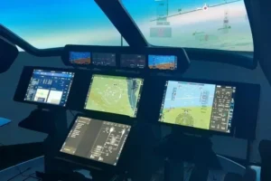
Displays. In the early days of airborne weather radar, the systems used dedicated displays, but these have been superseded by today’s multifunction display (MFD) units. While this is a practical solution on crowded instrument panels, it’s worth noting that for airline installations, both Honeywell and Rockwell Collins supply dedicated controls for their new units. This comes from the airline philosophy that when using critical systems like radar, there should be no hesitation, or any possibility of key selection errors, both of which could arise with an MFD’s many different control sequences. As well, the RDR-4000 and the WXR-2100 use ARINC 453 display interfaces, and can therefore be coupled with other manufacturers’ ARINC 453 displays. Almost all other radars can only operate with their own MFDs, which in some cases can limit an operator’s system choices.
3-D Picture. This is an essential element in the performance of the new radars. Traditionally, weather radars display just what they "see" as their beams sweep ahead of the airplane at the tilt settings selected by the crew, producing a weather picture rather like a large flat slice of pizza. Changing the tilt setting causes that slice to disappear, to be replaced by a different one, maybe with other ingredients appearing.
The Honeywell and Rockwell Collins radars take a volumetric approach, where the antenna automatically and continuously sweeps the whole sky ahead through its complete tilt range, while also changing pulse lengths and gain at different ranges, and all the time storing every slice in memory, with every scan updating the previous one. You could think of the result as a stack of pizza slices, all being rapidly and continuously replaced by freshly cooked ones. And as discussed earlier, either pilot can switch his or her display to manual mode and adjust the antenna tilt and gain to examine weather at a particular altitude or range, or have it look down for ground mapping, without affecting the other pilot’s display.
In the manual mode, the height of a particular storm cell being examined by the crew has its altitude displayed on the screen, corrected for earth curvature. But interestingly, the antenna itself doesn’t actually respond to the pilot’s manual commands. It continues to sweep the total sky as before, and what the pilot sees is a virtually real-time extract from the system computer’s 3-D memory.
Ground clutter. Here, both companies have achieved significant breakthroughs, and both their newer systems present clear, weather-only pictures with no ground returns. Honeywell does this by incorporating a dedicated Terrain Awareness Warning System-like map in the radar processor, which correlates its stored data with that of the ground returns and removes them from the display. Rockwell Collins said while it also uses a terrain map, it takes a more sophisticated approach by internally assessing, and then compensating for, the relative reflectivity of the terrain versus that of the weather systems immediately above it.
Conversely, the 3-D memory also contains a complete picture of the ground returns derived from the lower sweeps of the beam, so the crew can select the MAP function at any time to obtain a clear terrain depiction with all weather effects removed.
Over the horizon. Clearly, due to the Earth’s curvature, the line of sight radar signals cannot curve over the horizon. In approximate terms, the horizon is 100 miles ahead at around 7,000 feet altitude, 220 miles ahead at 30,000 feet and 320 miles ahead at 70,000 feet. Any weather appearing beyond those ranges at the related altitudes will therefore be very substantial, particularly as the main radar reflectivity, i.e., the rain and wet hail occurs in the lower one third of a thunderstorm.
Depending on altitude, however, Earth curvature effects start much earlier — as close as 40 miles — and this can sometimes give a misleading impression of the severity of the weather ahead, since the beam may be scanning the upper level of a storm and missing its more hazardous lower section. The 3-D memories of the RDR-4000 and the WXR-2100 correct this effect by inserting significant lower altitude weather returns, uncluttered by terrain, into the display. The benefit of this can be seen in the case of an aircraft with an earlier radar system cruising at a higher altitude with its antenna set at zero tilt. Its display would show a storm system apparently dissipating as it drew closer, thereby suggesting it was safe to overfly. In fact, it may not have dissipated at all, but was gradually falling below the radar beam. This could be misleading, since frequently there is an invisible "bow wave" of clear air turbulence above an active thunderstorm. In such cases, the new radars continue to display active weather cells as long as they are retained in memory — in other words, until they pass below and behind the aircraft.
Flight path following. When a climb, cruise or descent flight path has been entered into the flight management system, both new radars will automatically optimize the display to portray weather ahead along the aircraft’s horizontal and vertical flight path. For example, in a large, non-convective air mass with embedded heavy rain, the weather in the early part of the climb as the aircraft passes through the system would be displayed, but further out it would no longer appear, even though it persisted at lower altitudes, because the aircraft’s planned flight path would by that time be in clear air above it. The reverse would be true during the descent.
Automatic gain. Distant weather systems have less reflectivity than closer ones, leading to the possible assumption that they may be less hazardous, whereas the opposite might be the case. Automatic gain takes this diminished reflectivity versus distance into account, and presents the pilots with a comparable picture of the relative intensity of all storms on the display.
Turbulence mapping. Some higher-end conventional weather radars provide turbulence mapping using Doppler techniques, which essentially measure the rate at which raindrops move away or towards each other in very disturbed air. Other systems simply measure the increased severity of the rainfall. Both can indicate the strong likelihood of turbulence and, when they exceed the intensity level required to trigger the red colored "heavy rain" areas on the display, their warning areas are commonly displayed in white or pink.
However, while each method works, they do not present the fine grain analysis of just how turbulent the area might be. That is, the area could be extremely rough for a King Air, but present only a "moderate chop" for a fully loaded 747. Pilots of both aircraft would, of course, avoid those areas but, at unavoidably close quarters, measuring their true intensity is extremely valuable.
To this end, both Honeywell and Rockwell Collins developed proprietary techniques and computer algorithms to better assess turbulent regions and their effects, specifically within 40 miles ahead. These enhanced turbulence detection programs not only include more precise ways to quantify the turbulence itself, such as phase measurements at different pulse lengths, but extend to integrating that data with such things as the aircraft’s speed, weight, altitude and airframe g-loading to automatically determine the aircraft response and display the expected ride quality to the pilots.
Windshear. Occasionally, a shaft of cooler air will descend from the base of a thunderstorm, strike the ground and disperse radially, rather like an inverted mushroom, with its outward flows moving apart at between 20 and 80 knots. An airport downburst would be extremely hazardous to an aircraft during take off or on its landing approach, when it would suddenly encounter an increased head wind, followed by a strong downdraft, and then followed by a rapid reversal to a tail wind.
The RDR-4000 and the WXR-2100 each provide windshear alerting systems, based on Doppler measurements, which automatically override other presentations on the display and trigger audio alerts to the crew. Generally, they are set to operate within five miles ahead of the aircraft and usually below 1,800 feet above ground level, and are accompanied with a distinctly colored area showing the shear plus bright yellow V-shaped bars pointing outward from the apex of the display screen and embracing the windshear area.
Yet even with these advances, weather radar development continues. One long outstanding requirement is that of detecting clear air turbulence, with lidar technology appearing to show the greatest promise, although there are suggestions that today’s X-Band frequencies might, with further processing, offer a solution. Extending the respective 40-mile and 5-mile detection ranges for turbulence and windshear events is another challenge, while scientists and engineers continue to investigate ways to further improve our understanding of atmospheric physics.


