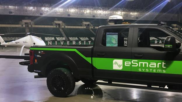
An IRIS situational awareness system is shown installed in the cab of an eSmart systems powerline inspection truck. The screen visible through the truck window plots the real-time position of a powerline inspection drone relative to the terrain, in addition to obstacles and airspace hazards. The inspection drone is launched from a slide in the back of the truck. Photo courtesy of Kongsberg Geospatial
Kongsberg Geospatial and eSmart Systems have partnered for unmanned aircraft system (UAS) powerline inspection, Kongsberg Geospatial said. Kongsberg Geospatial’s IRIS UAS situational awareness system has been integrated into the eSmart Systems Connected Drone solution.
“The expertise and capability of eSmart Systems is exactly the type of enterprise partnership we are looking for to employ our technology,” said Ranald McGillis, president of Kongsberg Geospatial.
Norway-based eSmart Systems’ Connected Drone collects real-time powerline-inspection data for analysis in the eSmart cloud, Kongsberg Geospatial said. It provides actionable data that can help reduce power failures and operational costs. The IRIS display enables one operator to manage multiple drones simultaneously. Kongsberg Geospatial said its system also provides real-time calculation of communications line-of-sight to enable beyond-line-of-sight operations. IRIS gives the operator real-time 2-D and 3-D visualization of airborne track and weather data, and has geo-fencing capabilities.
Kongsberg Geospatial said it has provided the military sector UAS platforms for over 10 years. It is currently working with industry and regulatory groups in the U.S. and Canada, in which the company is based, to develop a display for civilian drone operators.