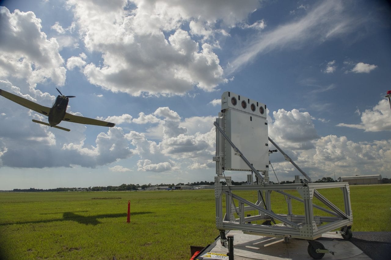
A Raytheon Skyler low-power radar array. (Raytheon)
Companies including Amazon, Uber and UPS are relying on the assumption that in the near future they will be able to safely fly aircraft through densely populated cities. Whether ferrying people or packages, traffic management in urban environments — especially unmanned traffic management (UTM) — is a challenge that needs solving for these companies to realize the promise toward which they’re investing.
With its low-power radar, newly dubbed Skyler, Raytheon thinks it has a solution that can fill all the coverage gaps and enable drones and air taxis to operate with the necessary tracking and maybe much more.
The ability to track aircraft in a city requires completely different radar than is typically in use, according to Skyler lead Mike Dubois. Skyler was borne of short-range weather radar and comprises distributed active electronically scanned arrays (AESA) piggybacking on cell tower infrastructure.
Traditional radar used for traffic management rotates, providing a view of a large area that updates aircraft locations every four to five seconds. That works well for a plane high off the ground that moves in a predictable path, but it leaves a lot of holes in a drone or air taxi’s urban use case.
In a city full of buildings, an aircraft will be making frequent turns, so updates have to be constant. As Skyler trades the range of traditional radar for AESA’s short-range, directed accuracy, it can help operators, agencies and other interested parties keep the necessary tabs on air vehicles.
A downside to the shorter range is that more radar installations are necessary. Raytheon’s strategy for dealing with this is to use existing cell tower infrastructure. In addition to being an easy inroad, this also combats another challenge facing traditional traffic management in urban environments: the curvature of the Earth’s impact on low-altitude flight.
“Below the radar is a real thing; the curvature of the Earth is a real thing,” Dubois said. “There are many instances, I think, where you’re not going to cover less than, say, a kilometer above the surface” with traditional radar. That’s particularly a problem for drones, which are legally required to fly no higher than 400 feet by the FAA without a waiver.
“This becomes a tool that supports the transition of aircraft from less than 400 feet where they can’t be seen by today’s radar to more than 400 feet where they want to go so that they can accomplish things like beyond visual line-of-sight,” Dubois said.
Raytheon also found it could harness the positioning of cell towers to its benefit.
“If you drive around, and you start looking for cell towers, it’s really amazing to see how strategically they’re placed,” Dubois said. “They’re on top of hills or they’re in valleys and they’re in there. To me, it always seems kind of obvious what they’re trying to overcome. … It’s really because they’re trying to get into people’s homes, to get things down to the street level.”
That same philosophy helps Raytheon fill out the radar picture, getting through and around potential blockages posed by buildings and trees.
Because the system originated as weather radar, and can still detect it and aircraft simultaneously, Skyler is sensitive enough to sense individual raindrops and granular enough to detect their shapes, according to Dubois.
“If you’re really going to be talking about drones delivering packages, that’s the kind of capability you need,” he said. “You can’t wait for a good weather day, [maybe] one in a month, for your stuff to come. … And that’s really the paradigm shift here, the taking of weather radar and applying it in a way that it’s never been used before.”
Currently, Raytheon has several low-power radar installations for researching the technology and demonstrating use-cases to potential partners. The ultimate goal is a nation-spanning network of radars integrated into the country’s cell towers, Dubois said. Raytheon sees it as something of an analog to its standard terminal automation replacement system (STARS) technology and imagines Skyler bolster its effectiveness.
“The data you get [from STARS] is only as good as the updates you get from the sensors,” Dubois said. “You think about the incident, what could have been a disaster, at San Francisco [International Airport, where a misaligned Airbus A320 came within feet of landing on top of another airliner last year] and, in that case, looking at the flight coming in would have provided even more data for decision-makers, for decision-support tools like STARS that will support preventing that kind of event.”
If enabling the urban air mobility revolution and drone package delivery while preventing commercial air travel tragedies sounds like a lot for one technology to take on, Dubois thinks Skyler can do more.
“I really think that we haven’t quite hit even the tip of the iceberg yet,” he said. “But the use cases are endless for what that possibly could do or how it could shape the future of the national airspace.”